How do the National Topographic System (NTS) map sheet labels work (e.g. 85J01)?
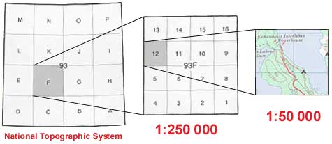
There are 3 parts to a map sheet label; the map series, map areas, and map sheet.
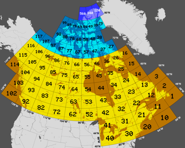
– 1:1,000,000 scale map series, denoted by a number indicating its general position in the country (e.g., 85). The following map shows all the map series numbers for Canada.

– Each map series is divided into 1:250,000 scale map areas, denoted by a letter (e.g., J). You can find the map series and map areas for the Northwest Territories here.
– Each map area divided into 1:50,000 scale map sheets, denoted by a number (e.g., 01).
These numbers and letters are then combined to form a unique designator for a map sheet, in this case 85J01.

1:50,000 Topographic Map Sheets (see bottom of page for map)
Below are some common map sheets in the Yellowknife area:
- Pauline Lake (85I03)
- Matonabbee Point (85I04)
- Jennejohn Lake (85I05)
- Hearne Lake (85I06)
- Ross Lake (85I11)
- Prelude Lake (85I12)
- Duncan Lake (85I13)
- Zenith Island (85I14)
- Pilot Islands (85J01)
- Foam Point (85J02)
- Ptarmigan Point (85J07)
- Yellowknife Bay (85J08)
- Prosperous Lake (85J09)
- Narcisse Lake (85J10)
- Awry Lake (85J15)
- Quyta Lake (85J16)
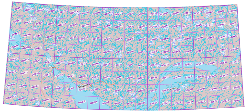
For quick reference, below is a map of the Yellowknife area showing the map sheet labels (click to enlarge).
